Gates Cambridge Scholar Sera Tolgay Marshall discusses her upcoming PhD in Engineering focused on understanding how hydroclimatic extremes, such as droughts, floods, and shifts in evapotranspiration, are transforming transboundary watersheds and her aspirations to bridge hydrology, remote sensing, and environmental planning to design practical approaches for land and water management.
By linking field data with Earth observation tools, I hope to help communities better anticipate and adapt to these extremes, and also show how protecting and restoring ecosystems can improve water availability and security. I look forward to collaborating with researchers, policymakers, and local partners to advance equitable water access and resilience to climate extremes in vulnerable regions worldwide.
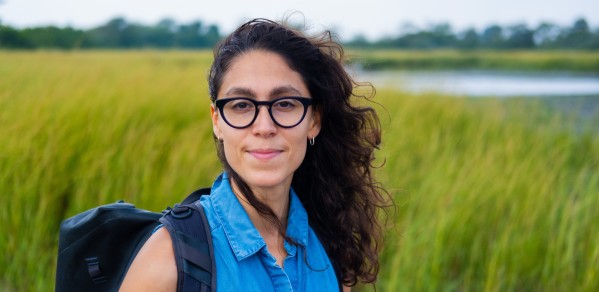
Sera Tolgay Marshall
Growing up in the coastal city of Istanbul, where ancient cisterns lie beneath neighbourhoods, I learned that our cities’ resilience depends on their relationship with water. Today, droughts can leave reservoirs dry while intense flash floods and storms can overwhelm infrastructure. Over the past decade, I have worked across scales, from coastal resilience projects in New York Harbour to basin-scale mapping of freshwater ecosystems in South Africa, seeking ways to design with, rather than against, water.
I’m excited to pursue a PhD in Engineering at the University of Cambridge that builds on these experiences to address a pressing question: how are hydroclimatic extremes, such as droughts, floods, and shifts in evapotranspiration, transforming transboundary watersheds, and how can we help communities adapt? These shifts are already being felt in people’s lives, from farmers losing crops to cities facing water shortages. Working with Dr. Edoardo Borgomeo, who is a leading expert on climate change and water management, I hope to bridge critical data gaps in transboundary basins, particularly in the Eastern Mediterranean, where climate change, conflict, and migration converge. Today, dozens of satellites monitor our planet’s water, vegetation, and climate, yet much of this information remains fragmented. My goal is to bring these datasets together and to turn complex satellite observations into accessible, actionable maps and tools that help communities and policymakers better anticipate water scarcity, prepare for extremes in the water cycle, and manage land wisely while repairing degraded freshwater and estuarine ecosystems.
As an urban planner and hydrologist, my work sits at the intersection of infrastructure planning, climate adaptation and water security. My professional experience spans about a decade in engineering and planning firms and in international development before that. Most recently, as Project Manager at SCAPE, I led nature-based infrastructure projects in flood-prone communities in the United States, working closely with engineers, planners and landscape architects, translating hydrologic modeling and climate science into plans and building resilient infrastructure and landscapes. Earlier in my career, I worked on infrastructure planning at WSP Engineering and with the New York City Department of City Planning in the aftermath of Hurricane Sandy on the city’s long-term coastal resilience and recovery initiatives. Our work focused on integrating flood risk data into zoning reforms in an effort to guide rebuilding in vulnerable neighbourhoods through community engagement.
These experiences strengthened my commitment to bring this knowledge back to regions where resilience planning is less formalised and data gaps can seriously limit adaptation. At NASA’s DEVELOP Program, I worked with a team that produced South Africa’s first national freshwater ecosystem map, applying satellite data to support the South African National Biodiversity Institute in tracking freshwater ecosystems and informing conservation policy.
The stakes feel most personal in the region where I grew up. The Mediterranean basin is a global climate hotspot, with climate models projecting up to a 40% decline in winter rainfall that could severely impact ecosystems, agriculture, and livelihoods. With support from the National Geographic Society, I have been lucky to be able to lead watershed conservation and post-disaster restoration projects, working with local NGOs and youth groups to monitor water quality, map flood risk, and advocate for ecosystem restoration after the 2023 Türkiye–Syria earthquake. Another project included a regional initiative to protect and restore more than 30% of the Sea of Marmara watershed, home to 27 million people and growing, by 2030 through cross-municipal coordination.
My academic journey has also evolved alongside professional practice, bridging environmental policy, hydrology, and planning. After earning a BA from Yale, I completed a Master in City and Regional Planning at MIT, where my research and fieldwork, supported by the Aga Khan Foundation, focused on the Jordan River Basin. This was my first experience working with remote sensing to develop a Drought Vulnerability Index that combined satellite-based data on rainfall, vegetation, land cover and salinity with field data to guide land use management for water conservation in a very complex transboundary river basin. Later, alongside professional practice, I pursued an MSc in Hydrology and Water Security at the University of Oklahoma, further developing an interest in hydroclimatology, modeling and data-driven water management.
With hydrological intensification—the process by which climate change amplifies both droughts and floods—many regions face growing uncertainty around water supply. I am very excited to join the Centre for Sustainable Development and explore how these shifts are reshaping transboundary watersheds in climate hotspots such as the Eastern Mediterranean, under the supervision of Dr. Edoardo Borgomeo. My research seeks to connect hydrology, remote sensing, and environmental planning to inform how land and water are managed in a rapidly changing climate. Harnessing the power of satellite-based Earth observation allows us to see patterns and processes invisible to the human eye, from evaporative stress using thermal radiometry to shifts in surface water elevations using radar altimetry, among many other tools. But in regions such as the Tigris–Euphrates Basin, where access to consistent data is scarce, the real challenge is not just collecting information but making it meaningful.
I am also very honoured to join the Gates Cambridge community, whose commitment to social impact aligns deeply with my own and also whose support is making this research possible. Linking field data with Earth observation tools can help communities better anticipate and adapt to these extremes, but this research also has the potential to demonstrate how protecting and restoring ecosystems is integral to improving water availability and security. Researchers like me have the privilege to serve those living on the frontlines of climate and water challenges. At its best, research can guide action, build trust, and shape our shared future on this planet.
2025 Gates scholars
2025 marks the 25th anniversary of Gates Cambridge, the University of Cambridge’s prestigious postgraduate scholarship programme.
The progamme, established by a generous donation from the Bill and Melinda Gates Foundation, supports academically outstanding and socially committed postgraduate students from outside the UK who wish to study at the University of Cambridge.
The Gates Cambridge Trust has selected 95 new scholars globally for this significant anniversary year, representing a diverse range of nationalities, backgrounds, and academic disciplines.
